
| Claim name: | End Run |
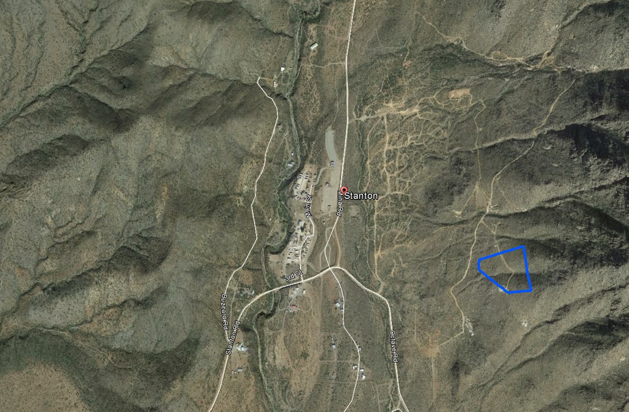
| Location: | Stanton, Arizona |
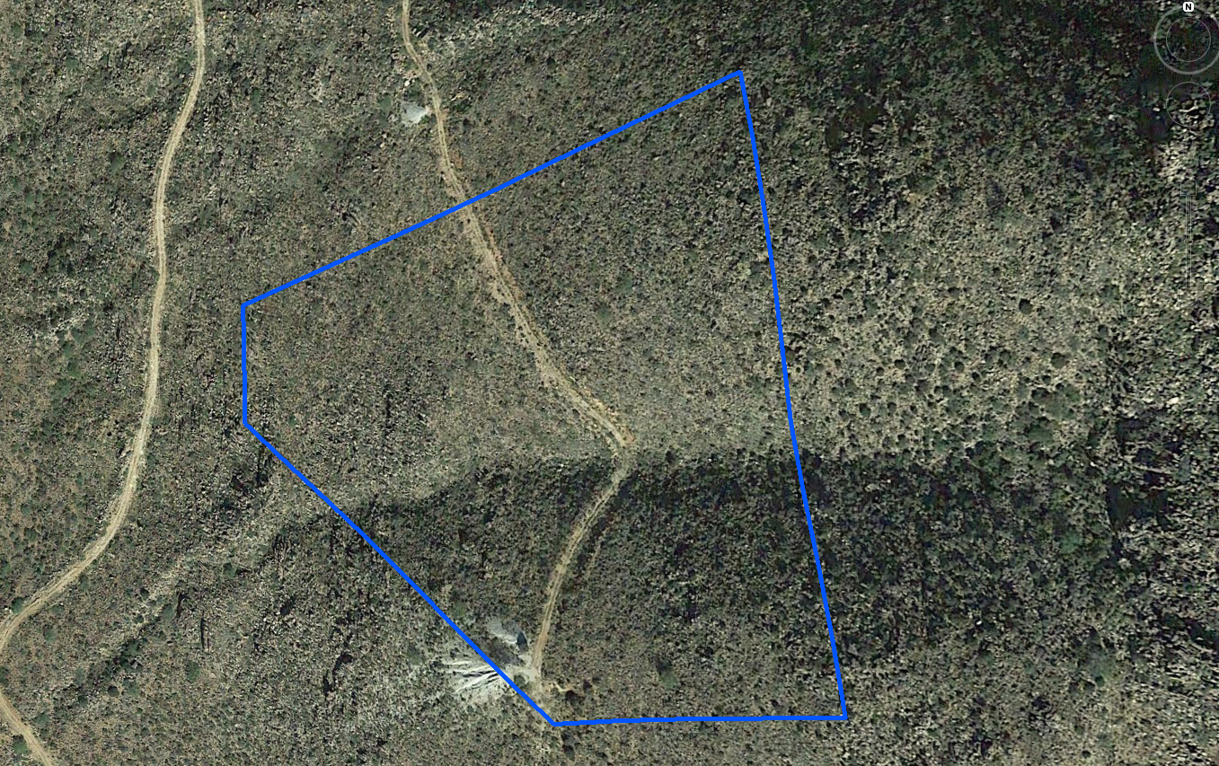
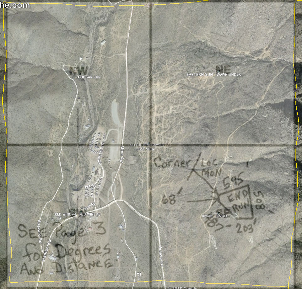
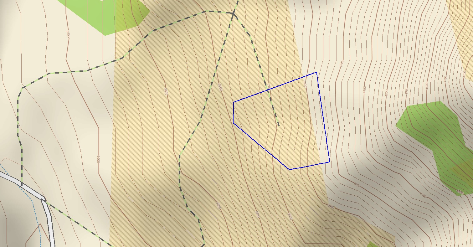
| GPS Corners | 34.162822 -112.723410 34.163340 -112.721695 34.161799 -112.721423 34.161667 -112.722260 34.162469 -112.723423 |
| Size: | 20 acres |
| Claim Description: | Located a few hundred feet outside of historic Stanton, Arizona. This area has a very rich history of mining. Anything from dust to flakes and larger nuggets. |
| Dangers: | Snakes. Dehydration. Heat, depending on the time of year. In 1892, a Prescott newspaper reported that the residents of Stanton liked to “drink blood, eat fried rattlesnakes and fight mountain lions”. Be careful out there. |
| Access: | Four-wheel drive, high clearance recommended. Access is via several un-named and un-signed roads, the pictures and maps below, as well as a good gps unit will help. Claim owners are especially sensitive in this area – for good reason. Please make sure you are on the claim before setting up your operation. |
| Gold: | Dust, flakes, and the occasional nugget. |
| Methods of mining: | Drywashing, recirculating highbanker, Metal Detecting. There is no water, except what you bring with you. |
| History: | Very interesting read: https://en.wikipedia.org/wiki/Stanton,_Arizona |
| Video: | For a panoramic video of the claim, (coming soon) |
| Directions: | Directions from Phoenix, AZ. can be found HERE |
Click on images below for larger pictures.
Aerial view:
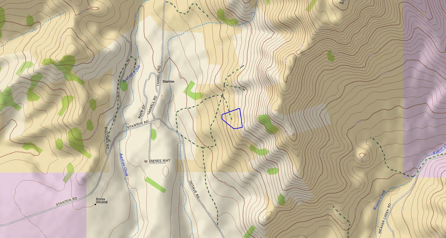
Topographical map of the claim:
For any questions about this page, or if you visit this claim and want to submit a claim report, please email stcullen@americanminingrights.com